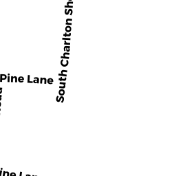
39 S CHARLTON SHORE RD
Owner Information
ORRELL GARY N (5/17)
39 S CHARLTON SHORE RD
CHARLTON, MA 01507


Property Details
39 S CHARLTON SHORE RD is classified as a Single Family Residential (Cape).
The primary structure on this property was built in 1940. There are 1,215ft2 of built area within this property. There is 1,215ft2 of residential/living space within this property. This property is listed as having 5 rooms.
39 S CHARLTON SHORE RD is valued at $383,800. The land is valued at $163,300 and the structures are valued at $219,900. There is an additional valuation of $600 on this property.
The most recent deed for 39 S CHARLTON SHORE RD is recorded at the local registrar in Book 57118, Page 124. 39 S CHARLTON SHORE RD was last sold on Monday, May 15, 2017 for $100.
Assessment data from fiscal year 2022.
Flood Data
This property is partially within the A Zone (within floodplain). Approximately 0.06 acres (28.07%) of the property is within this zone.
This information is sourced from the FEMA National Flood Hazard Layer. See our full disclamer.
Broadband Internet Providers
| Provider | Type | Bandwidth (mbps) | |
|---|---|---|---|
| Viasat Inc | Satellite | 100 | 3 |
| Charter Communications Inc | Cable | 940 | 35 |
| VSAT Systems, LLC. | Satellite | 2 | 1 |
| HughesNet | Satellite | 25 | 3 |
| GCI Communication Corp. | Satellite | 0 | 0 |
| T-Mobile | Fixed Wireless | 25 | 3 |
| Verizon New England Inc. | DSL | 5 | 0 |
Broadband service provider data from December 2020.